The designer was hoping for an award, but Startiblartifast got it instead, for Norway.
Fjords were ‘trendy!’ that year.
An enigma, wrapped in a dream, wrapped in a Bieber, wrapped in a Bumblefuck.
“Fnords were trendy…” there I fixed it for you.
The indentation on the North edge of the island need only be dammed in and it could then be the largest lake on an island in a lake on an island in a lake on an island.
All I see are islands and lakes. I don’t like where this thread is going. Don’t expect a reply
/whooshfnordwhoosh
either I’m confused or the first link is incorrect. the third link states
The world’s largest island-in-a-lake-on-an-island, however, is the volcanic island of Samosir in the middle of Lake Toba in Sumatra.
while the first wiki link states
This feature, one of the few in the world, can be deemed as an island in a lake on an island in a lake on an island.
damn this pedantry to hell anyway ![]()
Wouldn’t Isles Royale be the largest island on the largest lake? There is a large lake, on Isles Royale, with a large island. I call balony on this!
The article mentions that in all likelihood no human being has ever set foot on it, which seems plausible given that there’s never been a large human population in the extremely large surface area of Victoria Island, and it’s hard to imagine what would be so enticing about this particular splotch of land that it would possess a pre-contact Inuit to schlep a boat across all the portages necessary to get to it.
My point being, at least as far as dry land is concerned, this may be the best “discovery” opportunity left out there. I mean, obviously that’s the wrong word, but you know what I mean. The best chance at a geographic “F1RST P0ST!!!1!1!” to use the vernacular of our times. Obviously if it’s true that this place is totally untouched by humans, it’s true of tons of random sandbars in the Arctic, but this one is special, if only in the mildest possible sense.
Seriously, we’ve been to all the other “-est” places on the surface of the land. Highest, driest, wettest, lowest, most isolated, northernmost, southernmost, you name it. We’ve stood on every pole you can imagine. I have a friend whose life mission is to stand on all the U.S. “triple points” (where three states meet) and honestly that’s kind of what’s left to us in terms of that kind of accomplishment. Yeah, there’s “newest,” whenever there’s an undersea volcano, but that’s fleeting. You’re only the first guy on new land temporarily, because there will always be another new island popping up.
So if there’s a more impressive distinction (and I admit it wouldn’t take much) that we haven’t landed on, I’d love to know about it. Otherwise I’m off to talk to the King of Spain about funding my forthcoming voyage of discovery to the inland wastes of exotic Kanata.
so one would need a similar set up with alternating boats and trucks to visit such an island…

those two sentences do not sound contrary
The idea that this place has never been visit is very dubious. I’ve worked in Ulukhaktok (just to the northwest) and I know that people often travel to Cambridge Bay (just to the southeast) by skidoo. There have also be an number of groups that have kite skied across the island between the two towns.
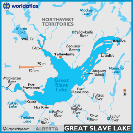
Southerners often look at the map of the north and in seeing just a few towns, expect the landscape to be empty. The opposite is the reality. We may only have 30,000 people in the territory but the trails often look like highways. Here is a map of the Great Slave Lake Area showing traditional trails. When you fly into Yellowknife in the winter you can see the skidoo trails that look just like this.
Though you may be right that no one has been there in a boat… I’m guessing the ice free season on the lake is a matter of weeks.
You could very easily be right, and it’s kind of an interesting thought experiment in general for the region (or other similar places). I mean, obviously, if it turns up there used to be an old mining town two miles from Lake Recursion then yeah, the local population density means that somebody probably wandered into any given grid square at some point. (Although it’s an incredibly small target, too, which could mean the claim was technically accurate even if the area was swarming with people at some point.)
But that cuts both ways–every town and settlement and snowmobile trail that brings people into certain remote places in Nunavut or Mongolia or Antarctica also means they go to fewer places than if they just randomly walked around the terrain. Snowmobile trails go where snowmobiles can go, hunters go where it’s easiest to hunt, loggers log the trees and not the tundra, miners stop where the uranium does, and so forth. You’re absolutely right that “empty” places aren’t usually “empty.” But just over the horizon from the many populated spots on the map of “empty” places is actual emptiness, by definition.
So I think this hinges on whether, at some point, one of those lines or nodes or areas of non-empty crossed very near this particular island-lake-island-lake-island. And, relatedly, how friendly to travel the larger area is taken as a whole (i.e., not just counting the places it was easy to build paths, but whether it would be easy or supremely annoying to go half a mile off the paths). I’ll defer to locals like you on that point.
Sorry – Samosir Island in Lake Toba on Sumatra is 3 1/5 times as big as Glover Island.
I agree that even with a thousand plus years of people travelling in the area there is a chance that no one has been to this particular point. I’ve put the question out to a few locals via facebook. Hopefully they’ll be able to tell us if they know anyone that’s been in the area.
Given that the area in question is relatively close to being on a straight line path between the two towns, there ought to be a a fair bit of traffic going through there. Unless people deflect south to a possible third node: the PIN-3 Distant Early Warning Site. Muskox hunters would be the people most likely to visit the area. They’d be following snowmobile “trails” in the loosest sense of the word. We had 100 Km/h winds for a week straight last week. The blown snow packs down hard and allowing snowmobiles to travel almost everywhere. This means that trails are generalized routes rather than fixed/marked pathways.
Canadian geography is fun. For example, Vancouver isn’t on Vancouver Island, Nor is Victoria on Victoria Island. But Victoria is on Vancouver Island even though Vancouver isn’t on Victoria Island.
Yeah, I noticed that too. Fuck fact-checking, we got ads what need clickin’.