Now that you mention it, I do have a zeal for crumpets, or anything else that can deliver melted butter straight into my face-hole.
Sort of a national cloaking device. That would be nice in the event of a nuclear war.
If a school classroom only has space or budget for one map, it should be Interrupted Mollweide:
It’s an exact area map with good shape accuracy.
If you must use a rectangular map, make it Equirectangular so that at least you can teach a little Cartesian coordinate geometry with it. But I say screw rectangular.
I would suggest skipping the first couple where he was finding his voice, and start with something like “Guards! Guards!”
One thing that I don’t think has been mentioned above is what should go at the centre of the map. The way things are going geopolitically and with climate change, I’d like to see a lot more maps centred on the North Pole. This really does bring home the actual spatial relations of the US, Canada, Russia, Japan and Northern Europe from a strategic point of view.
The only problem being that North polar projections tend to be even more Euro- and Ameri-centric.
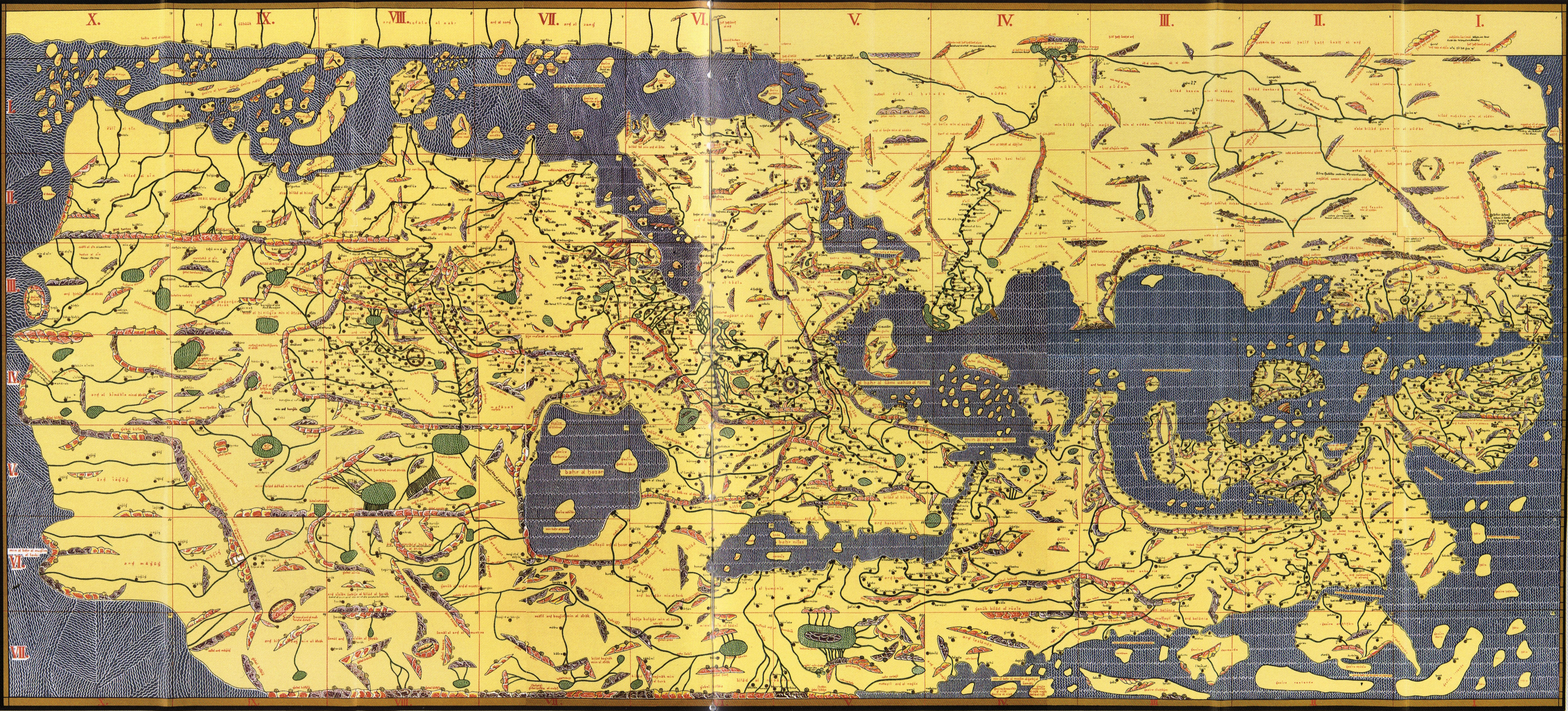
Nearly all of Australia, most of South America, and a huge chunk of Africa (plus everyone’s favourite map omission, NZ) aren’t even on that map.
Given the technical constraints it was pretty good for its day. Perhaps if the human race is around in 500 years people will laugh at astronomy textbooks from, say, the 1930s, and for exactly the same reason.
Yes… and noting that it was oriented with the north in the south. Maps are an interesting way of sussing out people’s world views and orientations, I think.
But I didn’t post it as a laugh, I posted it to illustrate that some people did orient maps in a different way.
It is also good at showing polar routes in 2D.
Can’t use Dymaxion because it’s against nationalism / showing nations. That scares away the nationalists, which is the intention. We don’t want nationalists sullying our map with their sorry crappy belief systems. Boston: hands off!
Just kidding actually, as many world maps are nation free. Boston has every freedom it needs to use Dymaxion, just chooses to turn its back on American Transcendentalist heritage. Using the Peters Projection is a way of affirming hate for Emerson and Thoreau, their publisher Margaret Fuller (Dial) and her grandnephew, the Dymaxion projectionist.
I just suggested rubber sheet distortion maps to @japhroaig in another thread, came back to look if someone mentioned it here and was not disappointed. @waetherman, @nimelennar: well done.
Stop projecting your anti nationalism on me!
(As I go for a pipe break in my geodesic dome home)
(Can I get Fuller of oddly specific jokes in this thread? Eh, I should buck it)
That’s a good one, but it’s still part of a subseries.
I’d be inclined to go for one of the standalones: Small Gods, for instance.
This topic was automatically closed after 5 days. New replies are no longer allowed.

