So you want to avoid nature on the way to seeing nature?
1 Like
In early January, Scott Gediman the NPS assistant superintendent for public and legislative affairs, told USA Today, “We feel Half Dome and El Capitan and the Ahwahnee Hotel (and other trademarked names at Yosemite) are part of the national park’s fabric. We feel those names are inextricably linked with Yosemite … and ultimately belong to the American people.”
The sentiment didn’t stop the National Park Service from changing them. A week later, the NPS informed DNC and Aramark that purchase of the trademarked names was not required. The NPS offered different names instead. The Ahwahnee Hotel became the Majestic Hotel, Curry Village became Half Dome Village, and Yosemite Lodge at the Falls became Yosemite Lodge.
Don’t forget traffic signs in French. ![]()
2 Likes
And other interesting languages.
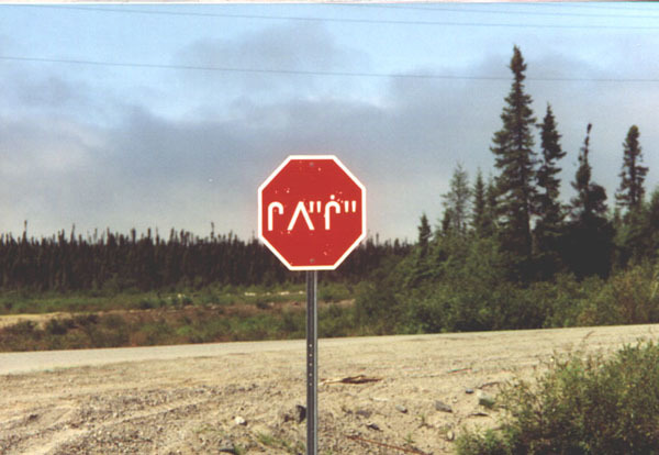
4 Likes
You must be ever so much fun at parties.
The things that struck me about the map was how few and far between the parks are … and after some digging how small they are, proportionately.
If you’re looking for land set aside for recreational / mixed use in the US we also have National Monuments, National Forests, and Wilderness Areas. The latter of all of those are the most protected, and some of the more pristine areas you can go to for non-motorized recreation. I’m not sure how many other countries actually have an equivalent.
1 Like
About 1/3rd of my country is set aside in various forms of protected area, from National Parks down. There are various degrees of ‘protected’ - Tongariro, for instance, has a couple of commerical ski fields, and 4WDs are common on the Orongorongo river flat. But generally they’re fairly tightly controlled, and only allow non-motorised recreation (off the formed roads)
2 Likes
Good to hear. I was just saying the National Parks are not the bulk of protected lands in the US. They are also fairly high traffic, and far less protected than other designated areas. There are no roads in Wilderness areas, for example.
ETA: By the way, beautiful mountains in your country.
1 Like
Yeah, I understand that. Thanks ![]()
1 Like
The UN hosts an interactive map of protected areas. I’m not sure if the data sets and qualifiers follow a global standard, but it’s interesting anyway.
2 Likes
Cool. I haven’t looked at that, but it sounds interesting. I’ll give it a spin.
1 Like
If flying cars aren’t allowed, I suggest anyone doing this run save the southernmost one (#11) for last. I wonder how fast your car needs to be going to make that 70 mile jump to the Dry Tortugas.
Watch out, you’re going to piss JonS off.
Why not aquatic cars?
Let me also suggest a visit to the largest park in the Lower 48, which has quite substantial wilderness areas with the strongest legal protection anywhere in the US. To make any change to the line would require a supermajority of both houses in two consecutive sessions of the state legislature, with a general election intervening - just to get the measure on the ballot for a popular referendum. I once spent two weeks on a solo trek about 2/3 of the way across it. It mightn’t have been the most “efficient” way to see it, but I had a blast (and came out with some great stories to tell in the local bar).
I’m blessed to live in a state that doesn’t have any national parks because it manages to do very well at wildland protection without them. There’s a lot less bureaucracy, too. For most of my state’s forest lands, I don’t need to enter a lottery for a permit or anything of the sort. I can just pack up my gear and go. (That will likely not last if it gets too popular, so stay away!)
Worst family vacation ever is when the family comes with you!!
2 Likes
I’ve tried taking other people’s families, but if anything the screaming is worse. Plus if you cross state lines it becomes a federal crime. Still, the escort from all those police cars was nice. I’ll post the pictures once the prosecuting attorney introduces them in to evidence.
9 Likes
I just wasted a few minutes looking through that map - it’s interesting that it looks at boundary=protected_area in OpenStreetMap for one of it’s references. (That’s cool! I can see my own handiwork transcribing a local database.)
For what it’s worth, if you zoom in on that diffuse green area in New York just south of the Canadian border, you’ll see a huge area of protection interspersed with private inholdings. My longest trek through there to date started just south of the McKenzie Mountain area, and traversed the High Peaks, Sargent Ponds, Blue Mountain, Blue Ridge, Moose River Plains, West Canada Lake, Jessup River, Silver Lake, and Shaker Mountain districts.
That’s my idea of visiting a lot of parks in a single trip. I wouldn’t take the family. There’s no way my wife is up to such a thing. My daughter might enjoy it if she had the time.
1 Like
There’s a ferry from Key West. (Can’t tell if it takes cars; my guess would be no.)
1 Like